Agricultural risk. Verified.
Register growers and fields, monitor every crop from orbit, price and verify risk, and settle claims, in one platform for Africa's insurers, lenders and agribusinesses.
Multi-crop, multi-peril · 44 years of climate data · Web platform and offline mobile app
The whole journey, field to claim.
01
Register
Growers, fields and seasons in one registry.
02
Monitor
Satellite, weather and ENSO signals, field by field.
03
Price
Parametric premiums built from decades of data.
04
Verify
Planting, frost and field assessments checked against evidence.
05
Settle
Signed claims, payouts and reports on the record.
See every field from orbit.
Satellite imagery, forecast and history in one view.
Field boundaries sit on live satellite imagery, with a seven-day forecast, historical weather and vegetation indices for each one.
Request a walkthrough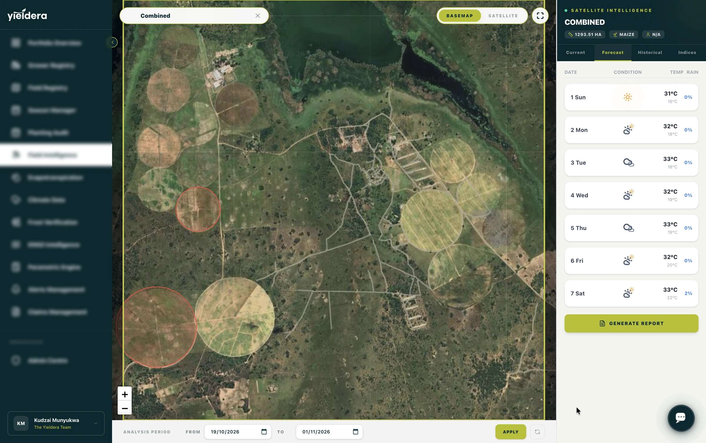
Know if the crop got enough water.
Water satisfaction scored field by field.
Rainfall, crop water requirement and available water are tracked daily against the growth stage, with a WRSI score and a plain-language agronomic summary.
Request a walkthrough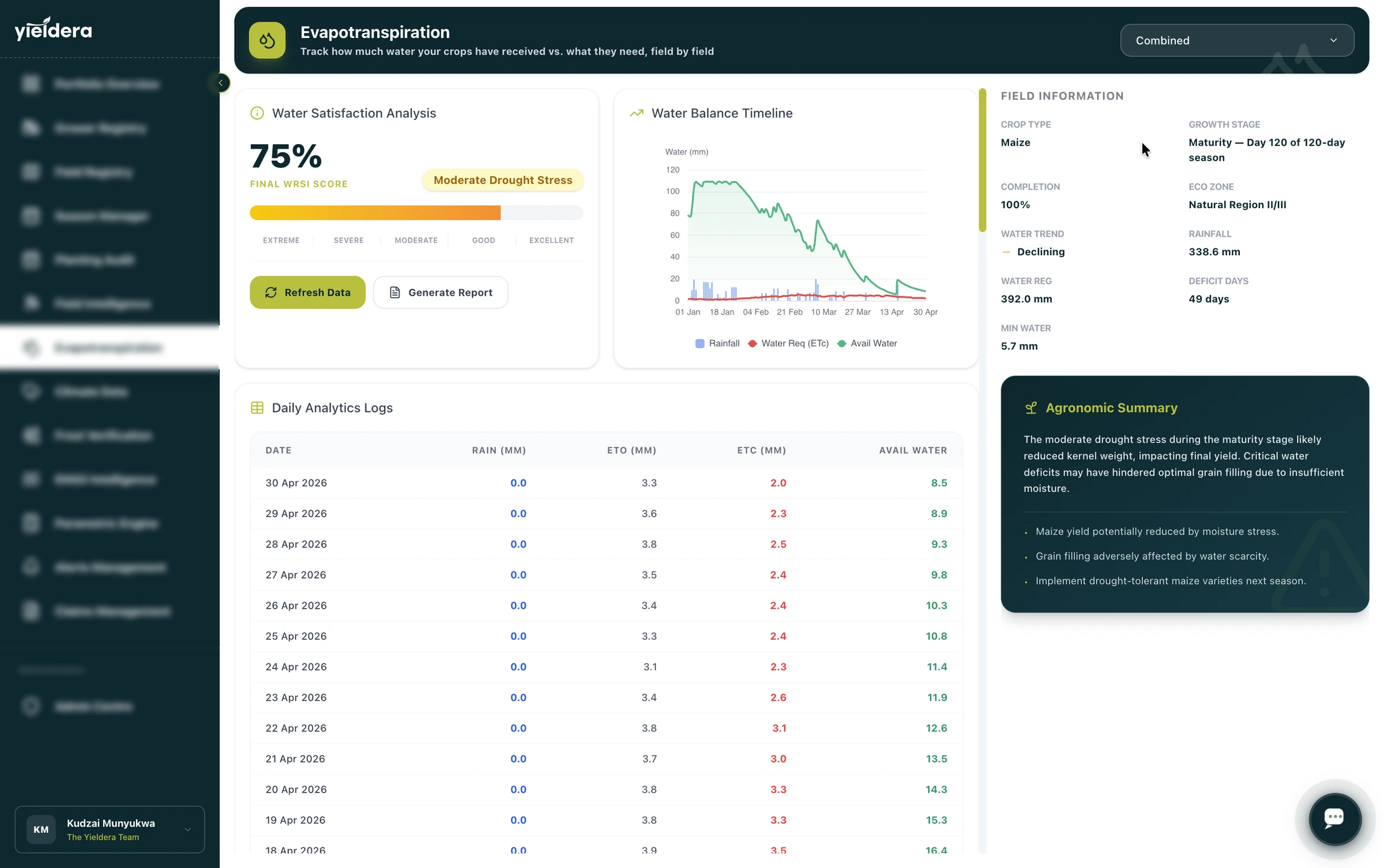
See the season before it starts.
ENSO signals turned into district-level risk.
Phase probabilities, rainfall signals and trigger risk, backed by 44 years of CHIRPS data, for every district you underwrite.
Request a walkthrough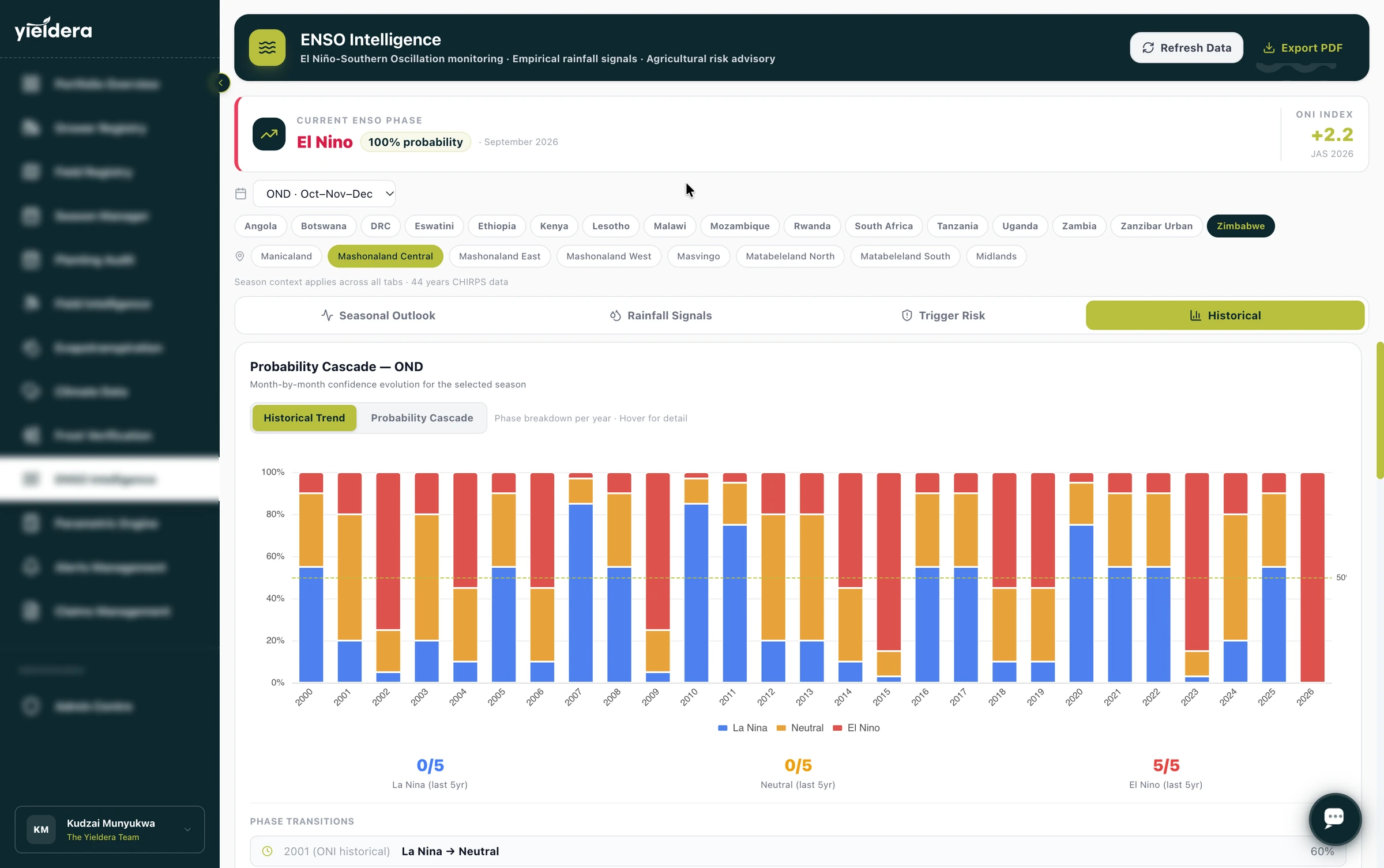
Know before the field does.
Threshold alerts by email and SMS.
Set temperature, wind, rainfall and NDVI conditions per field, and get notified the moment they are met.
Request a walkthrough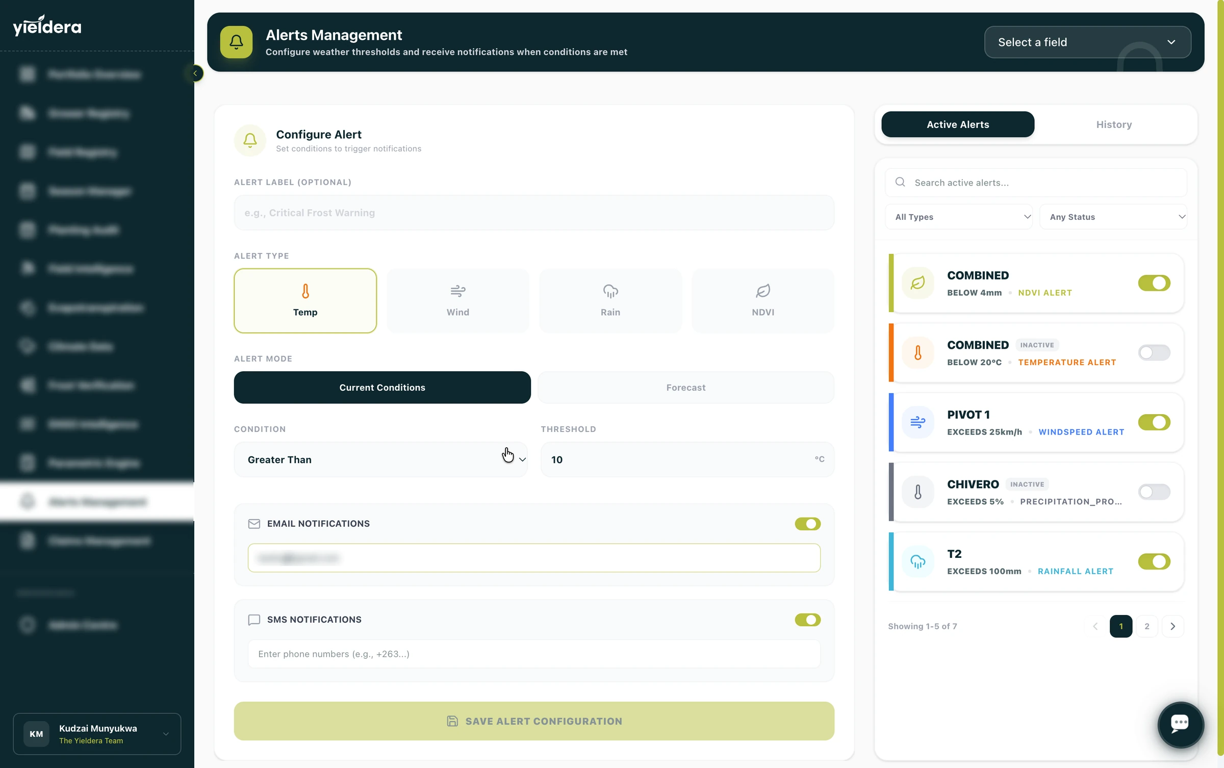
Price risk you can defend.
A transparent premium, from burning cost to technical rate.
Pure burning cost, safety, admin, reinsurance and margin loadings are itemised line by line, with an actuarial slip and reinsurance brief one click away.
Request a walkthrough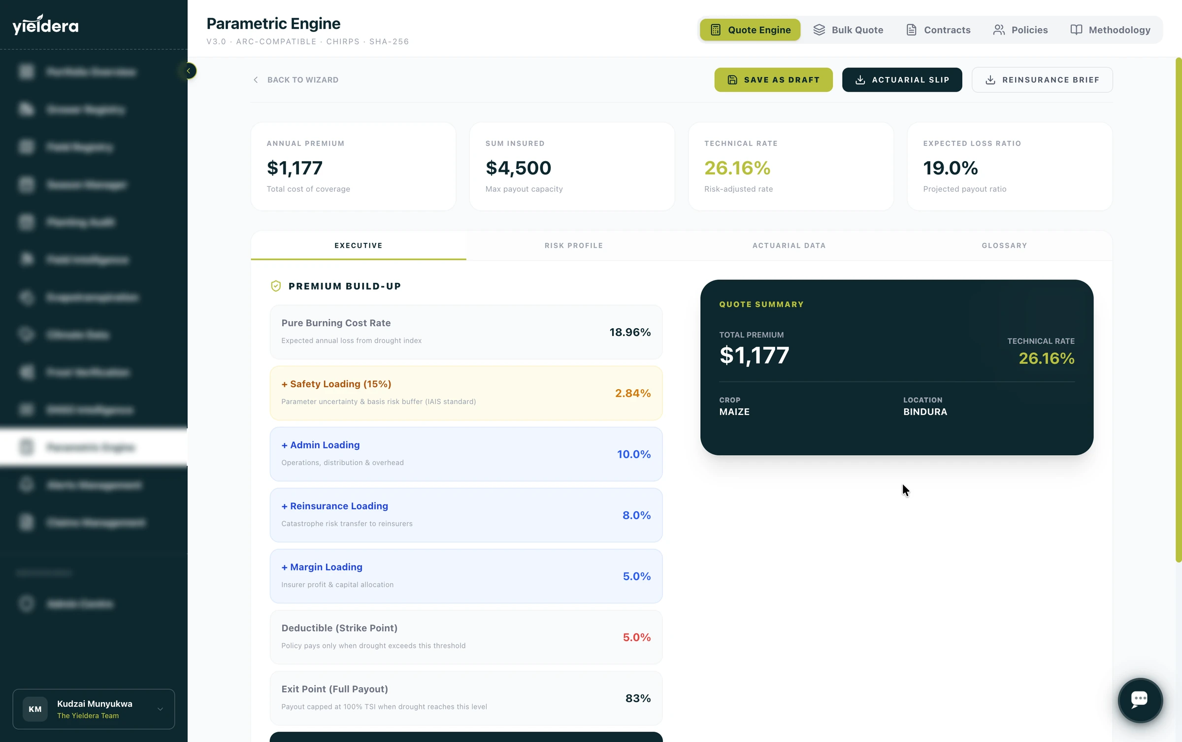
From trigger to payout, on the record.
Every claim is tracked, signed and auditable.
File, assess and approve claims by peril, with identity-signed records and payout amounts attached to each policy.
Request a walkthrough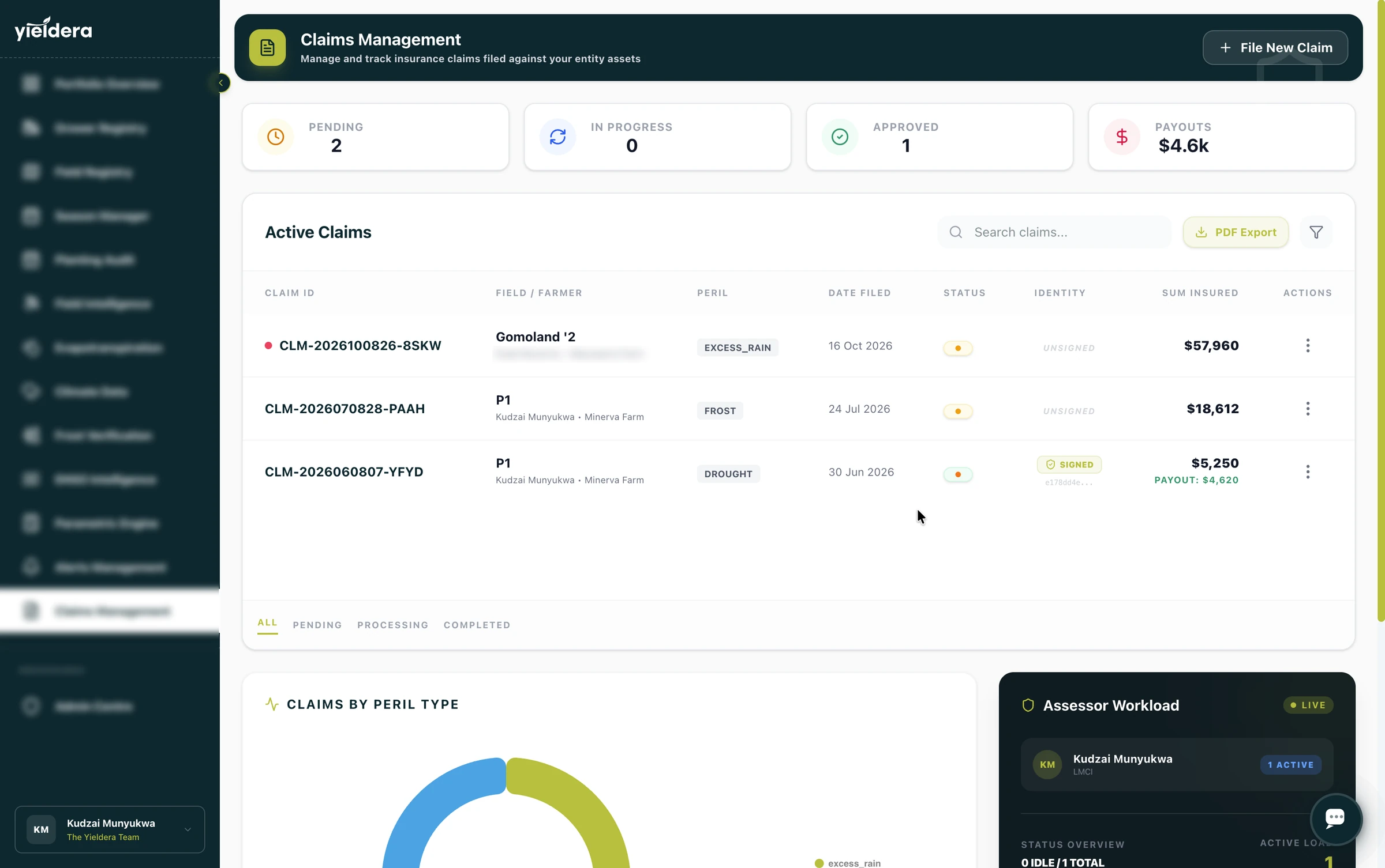
Built for the institutions of Africa.
From automated parametric payouts to continuous collateral oversight.
Insurers & reinsurers
Continental-scale underwriting with automated spectral loss assessment and parametric triggers.
- Spectral forensics
- Dual consensus
Banks & lenders
Monitor collateral health and mitigate NPL risk at pixel scale with sovereign-grade intelligence.
- Collateral indices
- Repayment risk
Agribusiness & NGOs
Regional supply chain visibility and yield forecasting for food security and commercial optimisation.
- Supply oversight
- Impact metrics
Planetary-scale, Africa-centric.
Periodic satellite passes, a multi-index parametric engine, and enterprise-grade security — all working together behind a single institutional platform.
Multi-Spectral Satellite Monitoring
Satellite passes deliver NDVI, WRSI, frost probability, and water stress readings at field level — no manual sampling required.
Parametric Index Engine
NDVI, WRSI, evapotranspiration, and frost probability computed over 20+ historical seasons — giving actuaries backtested evidence to price triggers with confidence.
Bank-Grade Security
AES-256 encryption at rest, TLS 1.2+ in transit, JWT authentication, and entity-scoped data isolation across every account.
Priced and monitored for
Continental Intelligence Metric
GPS Check-In
Geofenced check-in verifies the assessor is physically on-site before the assessment begins.
Photo Evidence
Geotagged, timestamped photographs captured at every sample point — embedded in the audit record.
Digital Signatures
Farmer and witness signatures captured on-device and cryptographically attached to the assessment.
Offline-First Sync
Full functionality in zero-connectivity field conditions. Data syncs automatically when back online.
Field-grade. Offline-capable.
The Yieldera mobile app puts actuarial-grade loss assessment in the hands of every field agent — with or without a signal. GPS check-in, photo capture, digital signatures, and draft saving all work offline. Every assessment syncs to the platform the moment connectivity returns.
Our partner ecosystem.


Turn agricultural risk into intelligence.
See every module live — from planting audit and parametric triggers to Scout AI and the mobile assessor app. One walkthrough, your actual portfolio questions answered.